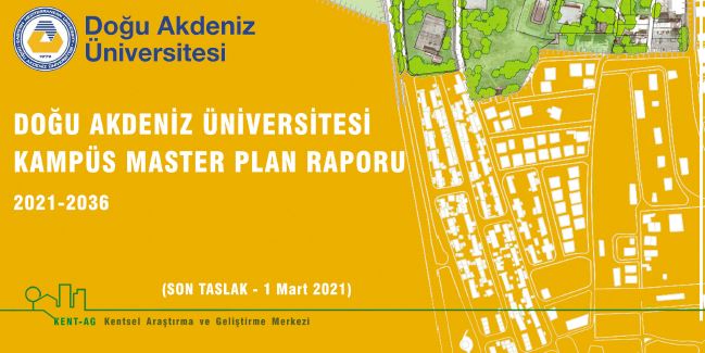
EMU Campus Master Planning 2025
Based on the never-legalised Master Plan of the EMU Campus, a new team under URDC is now working on the improvements and updates of the EMU Campus planning. The vision of the EMU Campus Master Plan is: A campus where users can walk and cycle freely without traffic interference; where public open spaces and pedestrian zones are actively used without being affected by climatic conditions; and where modern transportation systems are available; and where campus users are pedestrian- and bicycle-friendly, inclusive, accessible, and safe.
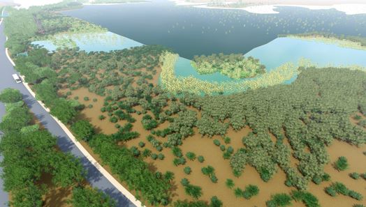
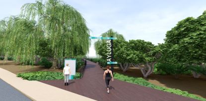
URDC Contribution to the design of Ayluga Natural Life Park in Famagusta
In February 2024, a protocol was signed between Famagusta Municipality, Eastern Mediterranean University, and the NGO MAKAMER (Famagusta Women Center) to ensure the protection of the Ayluga Lake area in Famagusta. The main goal of the project was to establish the area as the "Ayluga Natural Life Park." URDC contributed to developing the core design ideas and visual presentation of the project, with direct involvement from Assoc. Prof. Dr. Muge Riza and the consultancy of Assoc. Prof. Dr. Nevter Zafer Comert, vice directors of URDC, along with Research Assistant Amirhossein Karimizadeh.
The establishment of the Ayluga Natural Life Park will not only help conserve local ecosystems but also serve as a platform for raising environmental awareness, encouraging community engagement, and promoting Famagusta as a city that values and protects its natural heritage.
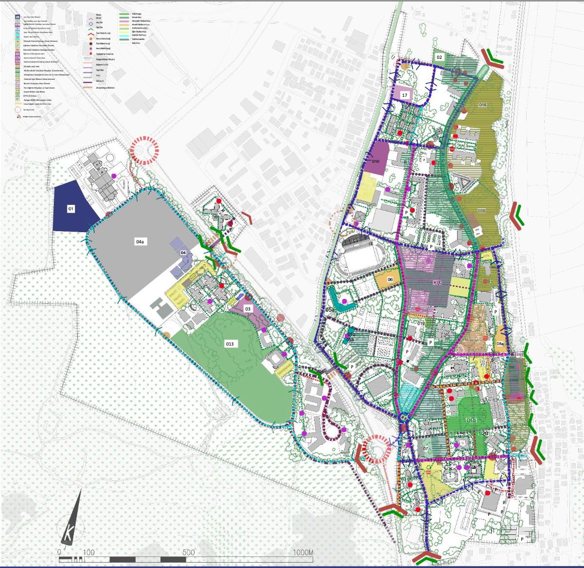
EMU Campus Master Plan - 2021
With the change of the rectorate the campus planning process is still ongoing.
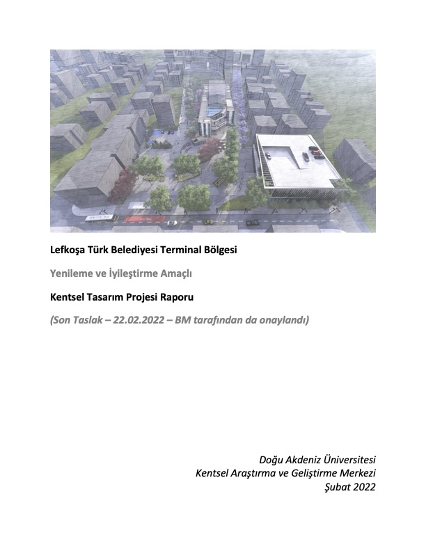
Nicosia Turkish Municipality
Terminal Area - Urban Renewal, Improvement, and Design Project
This is a research-based project carried out by the following project team under EMU-URDC, based on the protocol signed by the EMU Rectorate and Nicosia Turkish Municipality.
The urban renewal, improvement, and design project of the Nicosia Turkish Municipality bus terminal area in Nicosia Central Business District (CBD) covers a proposal for a new mixed-use complex and a public space. After a thorough analysis and evaluation, the project aims to transform the area into a sustainable and liveable area. The study is research-based, relatively micro-scale, 'planned urban renewal process' led and publicly structured and aims at environmental, spatial, social, and economic-based urban improvement and development. The project area under study, with the existing intercity bus terminal building, the Municipal Theatre building, the Municipality Building, and the parking lot in front of it, is a public area that should be evaluated within the scope of urban renewal and should be improved and developed through a strategic urban planning and design approach, to provide the citizens of Nicosia, sustainable, healthy, resilient and inclusive public spaces.
Project Team
Assoc.Prof.Dr. Ercan Hoşkara (Coordinator), Prof.Dr. Şebnem Hoşkara, Assoc.Prof.Dr. Nevter Zafer Cömert, Dr. Can Kara (Urban Planners, Advisor), Cenk Atun (Architect of the Theater Building, Advisor), Amirhossein Karimizadeh
Activities covered
- Site analysis, site synthesis
- Vision and strategy development
- Public participation processes
- Urban Design process
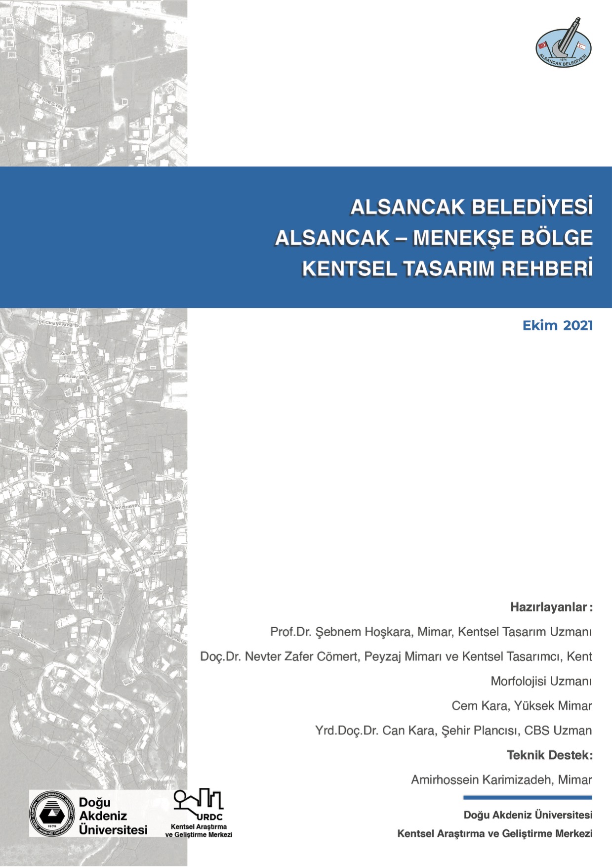
Alsancak Menekşe Region – Village Pattern Conservation and Design Guidelines Project
Alsancak Municipality
Alsancak Menekşe Region
Urban Design Guidelines
This is a research-based project carried out by the following project team under EMU-URDC, based on the protocol signed by the EMU Rectorate and Alsancak Municipality, on 27 February 2018, for preparing the Urban Design Guidelines for Alsancak Menekşe Region with the aim of conserving the traditional texture of the village.
Project Team
Prof.Dr. Şebnem Hoşkara (Coordinator), Assoc.Prof.Dr. Nevter Zafer Cömert, Part-time Instructor Cem Kara, Urban Planner Can Kara (on behalf of the Municipality), Aminreza Iranmanesh, Nima Mousavi
Activities covered
- Research on Urban Design Guidelines in Turkey and Europe
- Site analysis in the village
- Preparation of the maps
- Preparation of the urban design guidelines
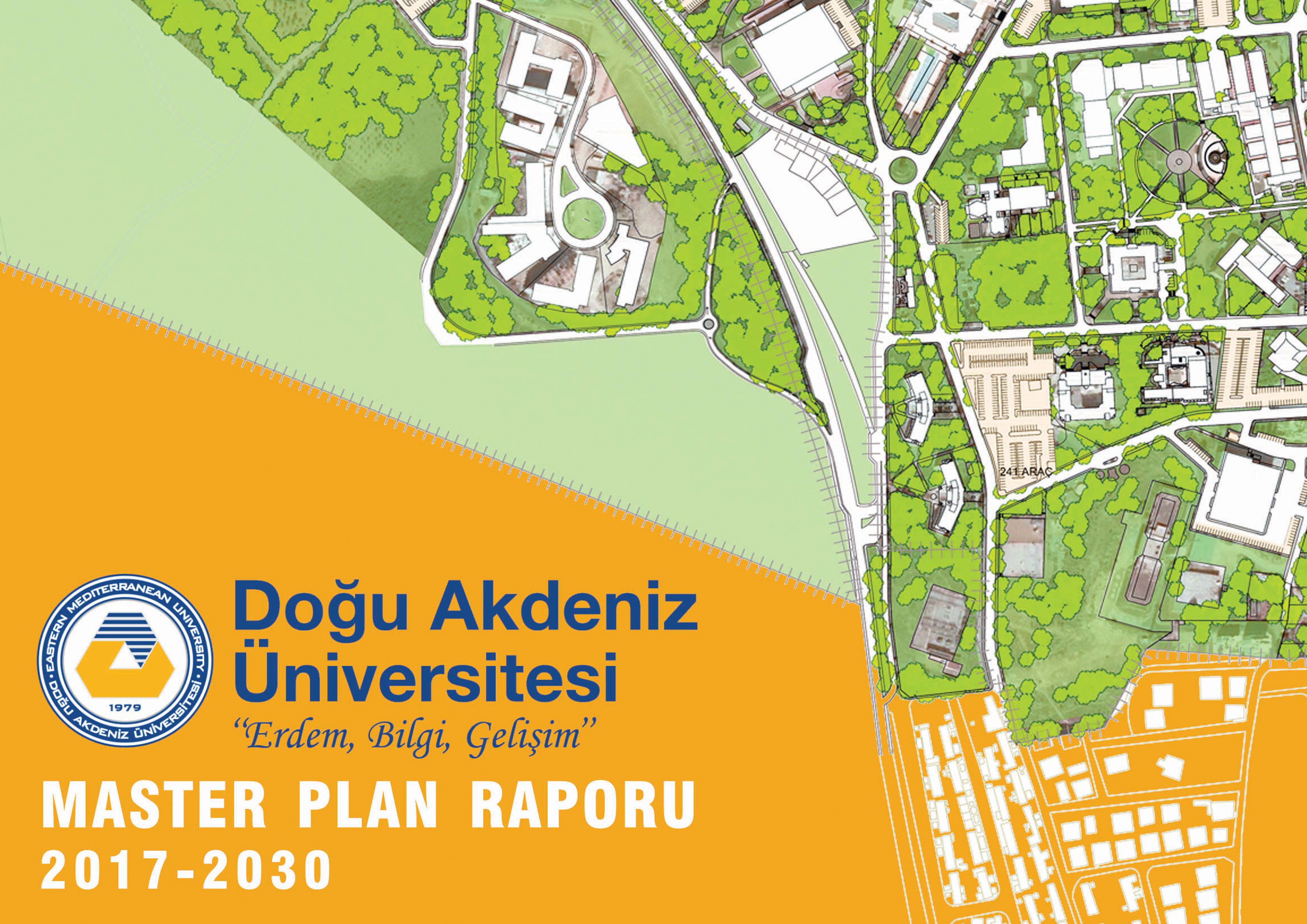
EMU Campus Master Plan - 2017
Based on the duty assigned to the Center by the Vice rector's Office on 17.11.2015 by an official letter with reference number RKY01-2015-0886.
Project Team
Prof.Dr. Şebnem Hoşkara (Coordinator), Prof.Dr. Naciye Doratlı, Prof.Dr. Mukaddes Polay, Prof.Dr. Beser Oktay Vehbi, Assist.Prof.Dr. Nevter Zafer Cömert, Assist.Prof. Ercan Hoskara, Res.Assist. Aminreza Iranmanesh, Res.Assist. Nima Mousavi
Activities
- Collection of previous studies, analysis, etc.
- Updating the site analysis
- Carrying out an online social survey with Campus users (both academic / administrative staff and students)
- Working with related stakeholders / units within the University
- Planning and design process
- Feedback from the Rectorate
- Reporting and finalizing the master plan
The Master Plan in Draft format is submitted to the Rectorate on September 5, 2018 and waiting for an official feedbcak and approval
"MEASURING THE QUALITY OF LIFE IN GAZIMAGUSA (FAMAGUSTA)" (FUNDED BY TUBITAK / The Scientific and Technological Research Council of Turkey)
Project period: September 2006 – May 2008 (extended until 15 September 2008)
The aim of the project: The project, accepted as a part of an
International Program of Research on the Quality of Life in Cities directed at the University of Michigan, is directed toward measuring the quality of life in the city and its surroundings, and determining the role played by the socio-physical environment in contributing to the health and well-being of its citizens. The socio-physical environment consists of many things including people's housing and neighborhoods, the public services available to them and patterns of formal and informal interactions among neighbors. Such QOL studies geared towards improving the life in cities have been in the agenda of the EU and affects their look.
The Gazimağusa Area Study would parallel work with Istanbul (Turkey), Detroit (USA), Brisbane (Australia), Belo Horizonte (Brazil), Brabant (Netherlands), Linz-Salzburg (Austria), and nine other world cities currently being planned. This multi-city program of collaborative research will enable researchers from around the world to engage in comparative analyses, theory building, and writing. An edited book,
The Quality of Life in World Cities at the Beginning of the Millennium (Ed: R. Marans) is planned for 2010 with each chapter covering a participating city.
The intent of the Gazimağusa Area Study is twofold:
First, it will produce information that can inform local government officials and policy-makers as they plan for and implement programs designed to enhance the quality of life of their constituents.
Second, it will produce indicators that will be a baseline for assessing societal changes in the city that occur throughout the 21st century. Changes in indicators can be used to determine whether governmental initiatives are working and where they need to be modified.
The proposed study, in sum, has public policy-planning and scientific value and will contribute to the well-being of the city's citizens.
Another highly important dimension of the Gazimağusa Area Study is that a city located in the TRNC, which is internationally unrecognized, has been accepted in an international project comprising the world cities and institutions with its existing unlucky status. The project has the advantage of hopefully starting a lasting academic collaboration between University of Michigan and Eastern Mediterranean University.
Project Team:
- Prof.
Dr. Derya Oktay, Project Coordinator / Researcher (EMU URDC / KENT-AG)
Advisors:
- Prof. Dr. Robert W. Marans (University of Michigan) (quality of community life indicators, neighborhood and housing planning, environment and behavior, community development)
- Prof. Dr. Ruşen Keleş (EMU URDC) (political sciences + environment)
- Prof. Dr. Ahmet Rüstemli (EMU) (social psychology)
- Can Kara, MCP, Assistant Personnel (Coordinator of the Survey Application)
"LANDSCAPE-LEVEL RESOURCE ILLUSTRATION & VILLAGE CENTER ENHANCEMENT FOR BÜYÜKKONUK VILLAGE, N. CYPRUS" (FUNDED BY USAID – EDGE/BEARINGPOINT)
The research and development project "Landscape-Level Resource Illustration & Village Center Enhancement for Büyükkonuk Village, N. Cyprus" funded by the USAID - Bearing Point (EDGE) was successfully concluded following the seminars and the submission and approval of a detailed set of urban and landscape analysis, a revitalization project and reports, and a professional brochure promoting Büyükkonuk as a pioneer village for eco-tourism on the island of Cyprus.
The project, placed under the auspices of the Urban Research & Development Center, was coordinated within a multi-disciplinary research framework comprising architects, planners, landscape architects and topography engineers, in collaboration with the international experts of the USAID on the issues of economy and eco-tourism and with the Büyükkonuk Eco-tourism Committee. (The project period: December 2006 - May 2008 - after extensions)
Landscape-Level Resource Analysis Team:
Dr. Derya Oktay (EMU URDC) Coordinator (Principal Researcher)
Bülent Potak, M. Arch (Homeland Construction) Assistant Coordinator
Surveyors: Can Kara, Fodei Conteh, Ehsan Daneshyar, Reza M. Kia, Aslı Özgörün
Technical Service: CyprusArc Co. (GIS Application), Burak Keşkek (GPS Truthing), Dr. Senih Çavuşoğlu (Graphic Design)
Village Center Enhancement (Revitalisation) Team:
Dr. Derya Oktay
Landcape Advisory: Aslı Özgörün
Technical Drawing: Ehsan Daneshyar, Reza M. Kia
Landscape-Level Resource Illustration & Village Center Enhancement for Büyükkonuk Village, North Cyprus, a research and development project of Urban Research & Development Centre (URDC/KENT-AG) of EMU, funded by The United States Agency for International Development (USAID) was recently completed. The project aimed at promoting the eco-tourism potential of Büyükkonuk village and provide a prototype for other villages in North Cyprus.
Büyükkonuk (Komi Kebir) is one of the unique villages of North Cyprus, where traditional village life has been continuing due to its rich agricultural and eco-touristic potential. Büyükkonuk village with its unique geographical location is particularly important for tourism in Karpaz Peninsula. Considering the socio-economic structure of the village and its tourist attraction potential, Büyükkonuk was chosen as a suitable village to perform research and development for an Agro and Eco-Tourism.
The project brought together researchers from different fields such as architecture, urban planning, landscape architecture, topography engineering, and international experts of USAID for economy and eco-tourism of Büyükkonuk village.
In this project, owing to the potential of Büyükkonuk village of becoming an eco-village owing to its economic, social and environmental characteristics, and numerous resources to support a range of tourist activities (as the newly established "unfortunate" tourist complexes on the Bafra Beach will create a great potential to attract more tourists to the village), our approach first highlighted the idea of "Leading to Ecologically Sustainable Living" at all levels: in its vision and orientation, in the interpretation of the findings of site analysis, in the enhancement of the village center, in landscaping the central area, and in preparing the design/revitalization schemes.
The project consisted of two stages:
1) The Landscape-level Resource Illustration – based on the field survey methods employing observations at various time intervals, advisory by international eco-tourism experts, landscape designers, biologists, and interviews with local inhabitants of the area, photographic documentation, GPS truthing, preparation of guiding maps with GIS (Geographic Information Systems) and a Büyükkonuk Eco-Village Brochure.
2) Village Center Enhancement (Revitalisation) – based on the literature review, observations, visual and functional analysis, advisory by economists and eco-tourism experts, interviews with the Mayor and other local authorities, local inhabitants and visitors of the area, photographic documentation, and Autocad drawings.
URDC/KENT-AG Team Members' meeting with village representatives and the Mayor of Büyükkonuk, Büyükkonuk, January 2007.
Ayios Phodios Mountain: the symbol of Buyukkonuk village
The surveyors during the landscape analysis around the village
Antique carob depository in the vicinity of the village
 Download PDF